
Photogrammetry for real estate development: what it is, how accurate it is, and where it fits
Key Takeaways
- Photogrammetry gives developers a verified reality layer of actual terrain, surroundings and construction progress that anchors marketing renders to the real site.
- Drone photogrammetry accuracy is bounded and predictable, running roughly one to three times ground sample distance, while centimetre absolute accuracy needs RTK, PPK or ground control points.
- A photogrammetry point cloud needs cleanup, decimation and texture work before it can feed an interactive 3D model in the browser.
- The highest-value program repeats site captures on a schedule and reuses them as investor updates and buyer-facing sales content.
A developer orders a drone flight over the plot before breaking ground. A few weeks later a survey package lands in the inbox: an orthomosaic, a point cloud, a set of volume figures. Someone checks the cut-and-fill math, signs off, and files the whole thing on a shared drive. Nobody opens it again. Meanwhile the marketing team commissions a separate 3D render of the finished development, and that render floats free of the actual site, its real slopes, the building next door, the road buyers will actually drive in on.
Two beliefs keep those deliverables apart. The first is that photogrammetry is a survey tool, something you buy once for measurements and volumes. The second is a quieter assumption that it somehow competes with 3D rendering, as if a point cloud and a marketing visual were rivals for the same job. Both are wrong, and the gap between them is where most of the value leaks out. Photogrammetry is not a survey, and it is not a replacement for your render. It is a reality layer: a measured record of the actual site that anchors the render to physical ground.
What the reality layer actually is
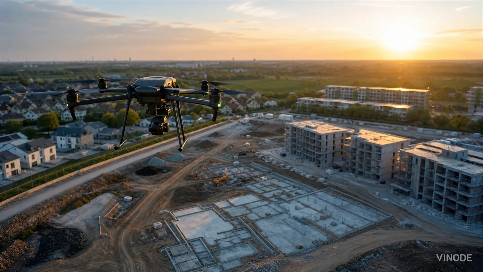
Photogrammetry means measurement from photographs. You fly or walk a site capturing heavily overlapping images, and software finds common features across those frames, estimates where each camera was, and triangulates the scene into a sparse then dense point cloud, a mesh, an orthomosaic, and a textured model. Esri describes it plainly as the science of obtaining reliable measurements from photographs and digital imagery, aligned with ground control and tie points so the output sits in its true geographic position. If you want the vocabulary in one place, our real estate 3D glossary defines point cloud, mesh and orthomosaic.
The definition is the on-ramp. The payload is what those outputs become in a sales context. Fed into an interactive 3D model, the capture supplies the base terrain and surroundings underneath the render: the real slopes, the neighbouring buildings, the approach roads, the sightline from a fourth-floor balcony, the parking that already exists. That grounding lets a marketing image show this specific building on this specific hillside, next to the adjacent block and the parking a visitor will see on arrival.
Nowhere does the reality layer earn its place faster than on an existing building. Adaptive reuse, heritage retrofits and brownfield sites all start from something already standing, and the drawings on file are often years stale. A photogrammetric capture documents the real façades, rooflines and site irregularities as they are today, so the model is built from the site's current conditions as they actually stand. Vinode already builds the 3D model of the buildings and their surroundings; a cleaned capture is one way to source that surroundings layer, which is why our writing on using 3D to showcase not-yet-built properties keeps returning to real site context.
How accurate a capture really is
Ask a vendor how accurate a capture is and you often get a number with no denominator. The answer that means anything is a ratio, and it is worth learning. Pix4D, whose software processes a large share of the industry's drone imagery, publishes the working figures: a correctly reconstructed and precisely georeferenced project generally reaches relative accuracy of roughly one to two times the ground sample distance horizontally and one to three times vertically. At a 5 cm GSD, that works out to about 5 to 10 cm horizontal and 5 to 15 cm vertical. Those are relative numbers, meaning the model is internally consistent with itself.
Absolute accuracy, tying the model to real-world coordinates, is a separate and stricter matter, and it does not arrive free with the flight. You earn it from an RTK or PPK drone, or from ground control points surveyed on the site, and there is a hard ceiling on what any of it can reach.
At a 5 cm ground sample distance that is roughly 5 to 15 cm, per Pix4D's guidance for a well-georeferenced project.
Source: support.pix4d.com - as of
The practical rule follows directly. If you only need terrain and context for a marketing model, relative accuracy is enough; the surroundings simply have to be self-consistent and convincing, and that internal wobble does no harm on a hillside nobody is measuring against a legal line. The moment you tie geometry to a boundary, a setback line or survey control, that tolerance stops being acceptable and you need absolute accuracy. The georeferencing method has to be chosen before the drone leaves its case, because it sets the ceiling on what the whole project can reach. Treat any flat claim of centimetre precision with suspicion until you know how the capture was tied to real-world coordinates.
The absolute accuracy of the results cannot be higher than the accuracy of image geolocation, or GCPs' accuracy.
Where photogrammetry stops
Photogrammetry reconstructs what the camera can see, and that is also its boundary. It does not see through vegetation, glass, water, reflective surfaces or heavy shadow. Fly a wooded plot in full leaf and the canopy hides the ground beneath it, so the model gives you treetops where you needed the terrain a foundation will sit on. This is the one place LiDAR genuinely wins: a laser scanner punches partway through foliage and copes with poor light, which is why survey crews reach for it under canopy. Where the subject has visible texture and decent light, photogrammetry returns a human-readable textured model, and it does so at a fraction of the hardware cost.
Accuracy is not automatic either. Poor image overlap, motion blur, rolling-shutter distortion, flat lighting, repetitive textures, moving cars and weak GNSS all degrade a reconstruction, sometimes invisibly. And the flight itself carries operational constraints that belong on the project plan from the start.
Photogrammetry or LiDAR
Reach for photogrammetry
One flight has to serve several outputs at once: an orthomap, a terrain base, façade references, a progress record you can repeat monthly. It runs on commodity hardware, so the budget goes to processing rather than the sensor.
Reach for LiDAR
The ground you need sits under tree cover, the light is poor, or the surfaces are glass and water. A laser scanner still returns usable geometry in conditions that leave a photo reconstruction guessing, at a higher hardware and processing cost.
Drone work means airspace checks, pilot qualifications, flight permissions and, on dense urban sites, privacy and data-protection obligations for whatever the camera records. These vary by country and are a planning item with a real lead time. Budget the permissions alongside the flight.
A point cloud is data, not a sales experience
Here is the step most developers never budget for. A raw point cloud or mesh straight off the processing software is a technical artifact, not something you drop onto a sales page. It is heavy, noisy, riddled with holes where the capture was thin, and far too dense for a browser to load. Turning it into a web-ready asset is its own pipeline: cleanup to remove noise and stray points, decimation to cut the polygon count, retopology to rebuild sensible geometry, texture processing, and finally import into the rendering toolchain.
That processed model is what loads in about two seconds in a browser, on an ordinary phone, without an app. Vinode's pipeline is engine-agnostic on the way in, accepting geometry from CAD, BIM and the usual DCC tools, so a cleaned photogrammetry mesh enters the same way any other model does, through import after processing. The biggest hidden cost of a reality-capture program sits in the processing and integration work between the point cloud and the sales page, and that is the line item that gets forgotten precisely because the drone footage already looks finished on the laptop.
The move almost nobody makes
Most reality-capture programs stop at the first flight. You capture the site, pull the measurements, and the work is treated as done. That is where the largest source of value goes untapped, because the one output a single flight can never produce is a record over time.
Repeat the capture monthly through construction and you build a dated visual record of the building actually going up. That record reaches three audiences at once. Investors and lenders get progress they can see for themselves. Buyers who committed off-plan get proof that the thing they paid for is real and rising out of the ground. And your sales team gets material it can drop straight into client touchpoints: your unit is at structural stage, your view corridor looks like this, here is the site as it stands today. Vinode's Back Panel already ties visuals to the unit and the deal, so those progress captures become part of how the sale is worked.
The reason this pays off is specific to pre-construction. A buyer is committing money to a building that does not exist yet, and the distance between a glossy render and the real state of the site is the uncertainty that stalls the deal. A capture taken every month narrows that distance on a schedule the sales team can plan around. So set the rhythm at the start of the project, before the first pour, so each capture lands in time for a client or lender conversation.
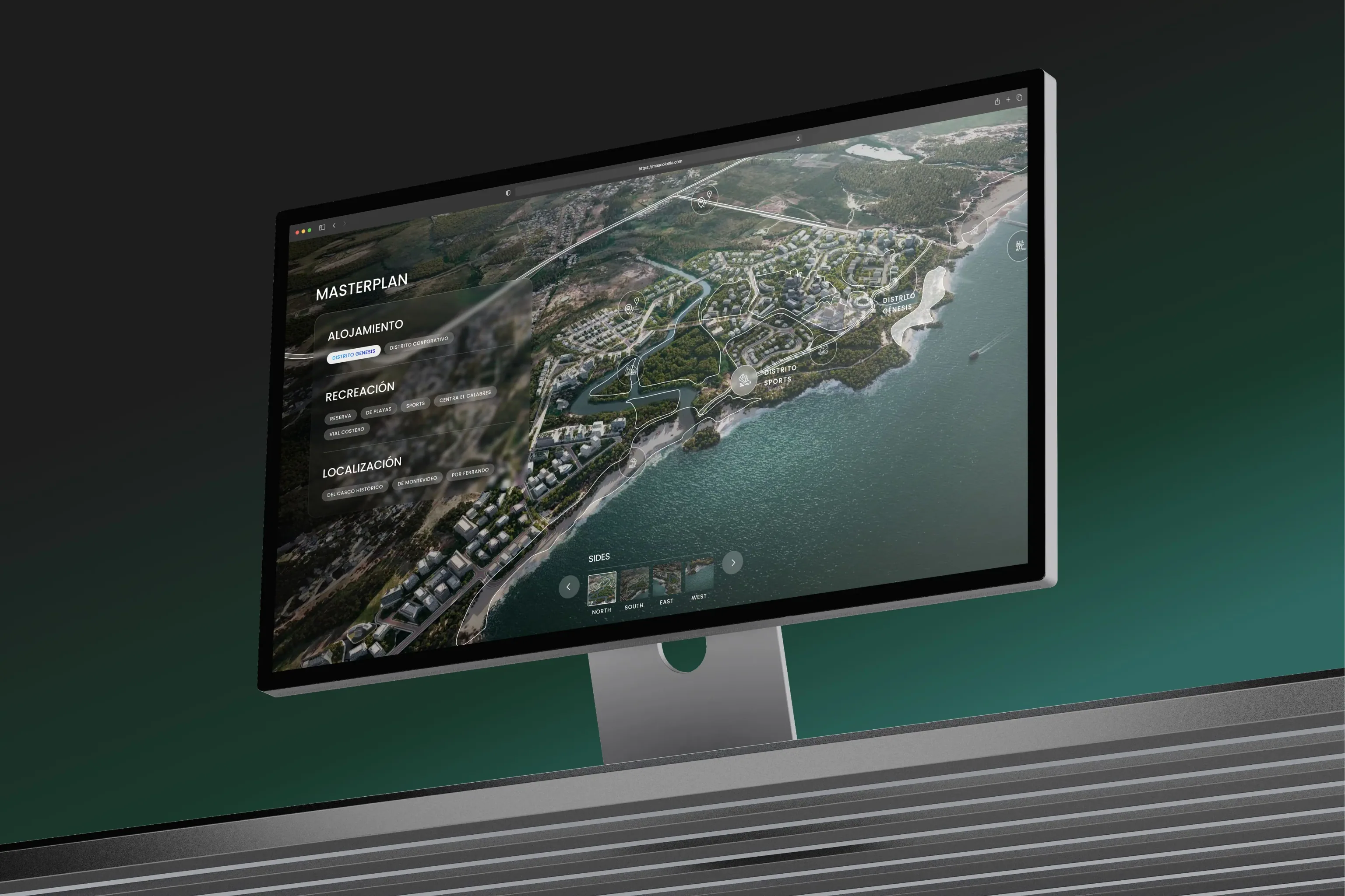
Scale is rarely the obstacle. A masterplan such as +Colonia spans 515 hectares of buildings and surroundings, and a reality layer is built to cover exactly that kind of ground. If your plans shift mid-build, the same discipline carries over to updating the render when construction changes.
The signal underneath all this
None of this is experimental. Drone capture is now a standard construction workflow, and demand for property visuals is measurable. The National Association of REALTORS 2025 technology survey found drone photography and video used by 52% of REALTORS, behind only e-signature and social media, and its 2025 staging research reports buyers' agents rating photos highly important to clients at 73%, videos at 48% and virtual tours at 43%. Those are US figures. Read them as directional evidence of where buyer attention goes, and localise before applying them to a project in Warsaw or Riyadh.
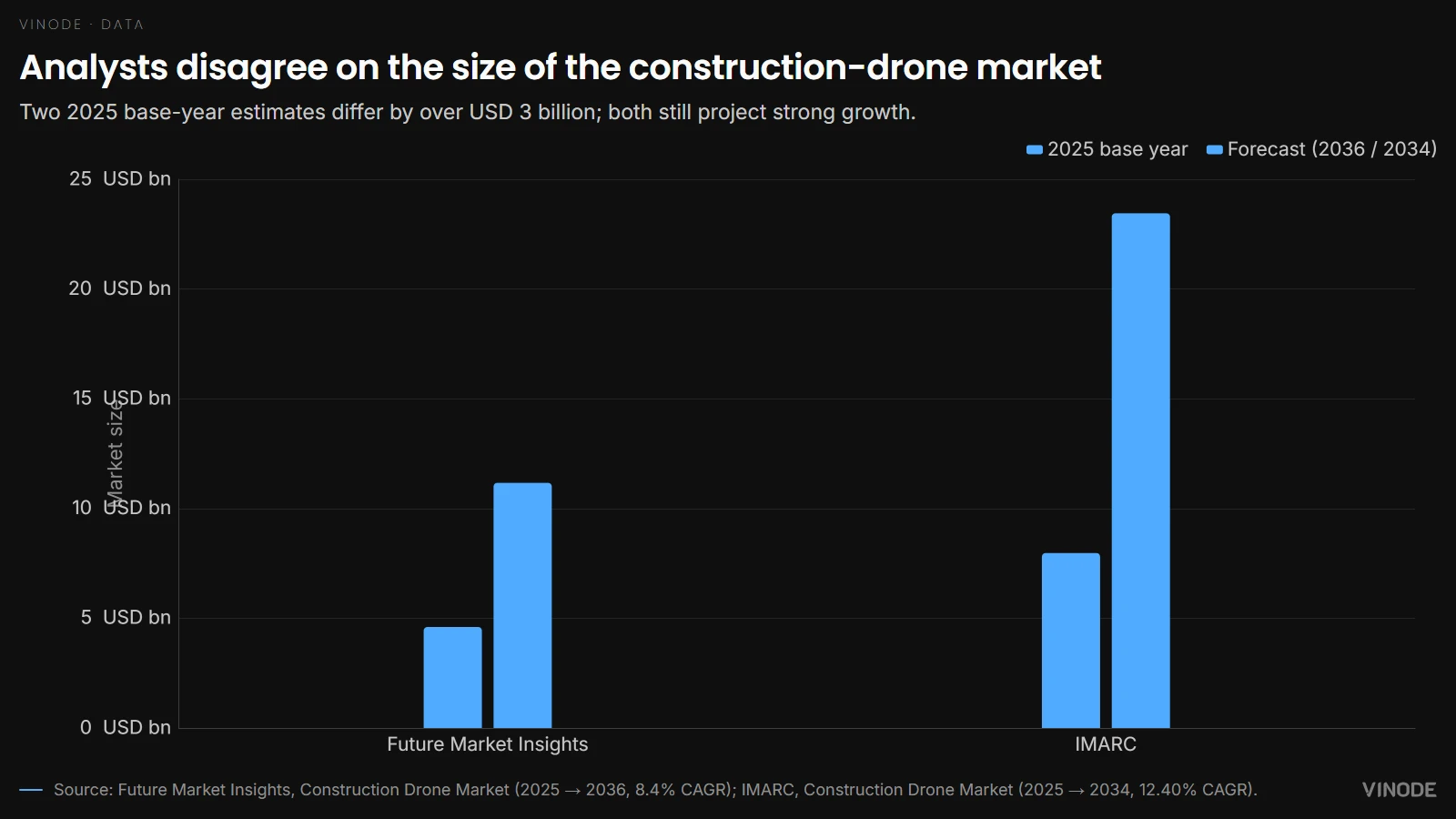
Market sizing tells the same growth story with far less precision. Future Market Insights values the construction-drone market at USD 4.6 billion in 2025, rising to USD 11.17 billion by 2036 at an 8.4% CAGR. IMARC, measuring the same market, puts it at USD 7.97 billion in 2025 reaching USD 23.45 billion by 2034 at a 12.40% CAGR. They disagree by well over a billion dollars on the base year alone, so read them together as independent signals of a growing market, with the precise figure still unsettled.
How to buy it without wasting it
If you take one thing into a procurement conversation, make it this. Treat reality capture as the physical foundation your render sits on, budget for the processing step that turns the raw capture into a web-ready model, and set the capture cadence around your sales and investor calendar. The recurring feed is what earns the cost; a single point cloud filed away after one flight rarely does.
This is not for every project. A single small unit with no surrounding story and no pre-construction timeline gets little from a drone program; the flight, the processing and the permissions cost more than the context is worth. The reality layer pays off when there is a site worth showing, a build worth documenting, and buyers deciding before the building exists. When that describes your development, the real question is how to keep feeding the reality layer into the experience that actually sells the units.
See a masterplan open on your own phone
The same interactive 3D that a reality layer feeds, running in about two seconds with no app to install.


How to Move a Live Property Launch Off a Spreadsheet
Three weeks from launch, new enquiries were going into a spreadsheet tab called new leads 2. Move new leads and current unit data first, let old deals finish where they started, and leave the historical import until later.

AI Property Imagery in 2026: A Trust and Governance Playbook for Developers
A label tells buyers that AI touched an image. It cannot tell your team which design revision supports the image, who approved its claims, where it is live, or how to withdraw it.
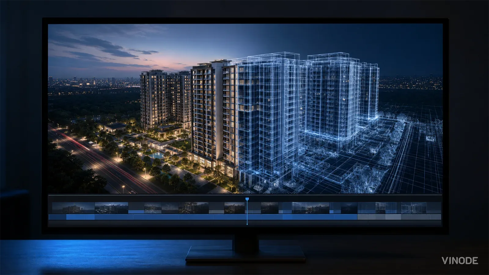
How to commission a development flythrough (and what to measure)
A sales director is asked by his board which reservations the launch film brought in, and cannot name one. What a flythrough can actually do, how to commission it so a later design change is one re-rendered shot, and what to measure instead of views.