
How buyers pick a plot on a housing development they have never walked on
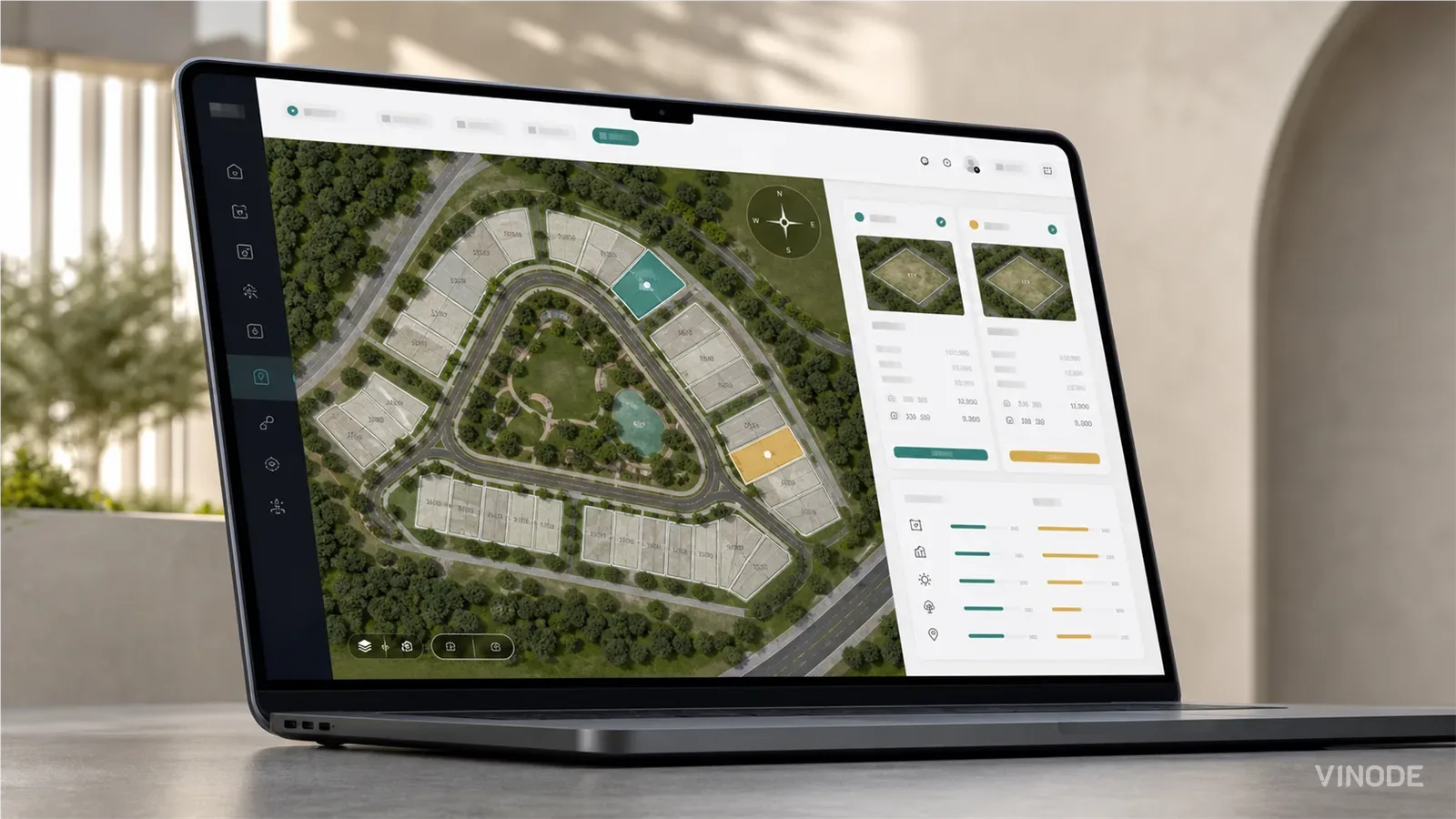
Image co-authored with help of AI for illustrative purposes
Key Takeaways
- Compass orientation, adjacency, live availability, and side-by-side comparison are the decision data buyers need before they can shortlist a plot remotely.
- Interactive maps work on small developments where buyers can scan every option quickly; beyond roughly 50 plots, filtering and comparison become necessary.
- Outdated availability or missing plot context turns digital browsing into undecided enquiries, leaving sales teams to qualify buyers from scratch.
Spring last year I spent a day in a client's sales office, before we started on their new site, to watch how their people used the old one. At eleven, I think, the sales lead, I do not remember her name, took a call from a buyer who lives abroad. He had picked plot 14 off the plot map on the website and wanted to reserve it. He asked which way the garden faced, and what was behind the back fence. She put him on hold, opened the architect's PDF on her second screen, found the north arrow and tilted her head to read it, then opened satellite map in another tab to look at the fence. He asked twice if she was still there. When she came back he said he would think about it. I watched her do the same lookup twice more before lunch.
He was really asking four things: which way the plot faces, what is behind it, whether it is still available today, and how it compares with the other plot he liked. A plot finder that already shows those turns that call into a reservation. The sales desk stops reading compasses off a PDF while a buyer waits on hold.
The case for a simple clickable map
The case against building those four answers into the map is stronger than we usually admit. Most estates still launch with a PDF site plan: plot numbers, house types, a north arrow in the corner. A clickable map is already a big improvement. That part is easy. You click a plot, see the price, area and status, then enquire. It can be live in a few weeks and, importantly, it does not create much extra work for the client. The map still takes work to set up, but it does not take much effort to manage afterwards. Once you start adding things like orientation and live availability, those details need updating as things change. If there is no clear owner for that job, the field quickly becomes a liability. A field that says 'available' when the house sold in March does more harm than leaving the information off the map altogether.
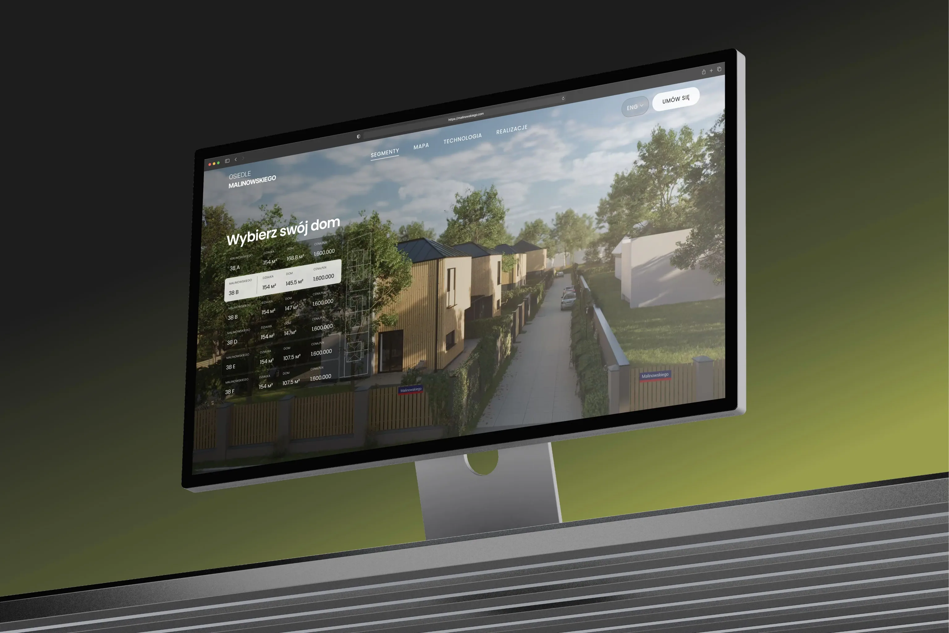
Malinowskiego is a good example of a small estate where the simple version does the job. It is six houses in Józefów near Warsaw, all on similar 900 m2 plots, and the site gives each house its price, size and availability from the back panel, plus a location map with distances to the forest, the school and the ring road. Filters and a comparison view would add little at six houses, because you can see the whole estate at once and simply pick one, so the site has neither.
Two estates, and what each one got
Malinowskiego, six houses
Homes 38A to 38F, 147 to 169 m2, one release, plots of a similar size. House picker with live availability, mapped location, 360 interiors. Small enough to browse house by house.
Kownatki, twenty houses
Homes of 84 to 108 m2 with four or five rooms, on plots from 1,228 to 1,504 m2, sold in three build stages. Filters on living area, plot area, rooms and price, favourites, comparison, a house card per home, 360 interiors.
Where the simple map stops being enough
The simple map works on one assumption: the buyer only needs to find the plot, and can ask about the rest. That holds as long as the buyer can drive over and see the plot for himself. Once he cannot visit, he still has the same four questions, so he calls, and the rep looks the answers up while he waits. By the time she is back on the line he has usually cooled off. Or he does not call at all. He fills in the form with just the plot number, and on Monday somebody at the sales desk starts qualifying him from zero. After enough of those, the sales team quietly stops trusting web leads, and that cost rarely shows up in any report. It is real all the same.
Garden orientation and the fence line
Garden orientation is usually the first thing buyers ask about a plot, and the UK numbers back that up.
42% would pay more for it.
Source: OnTheMarket, June 2024 - as of
We keep orientation on every unit as proper data: eight compass directions, plus ten view types from sea and park to street and courtyard. Because it is data, the page can filter and sort on it, and a corner plot can carry two directions. Whether the buyer also sees a compass drawn on the 3D view depends on how that particular project was set up, but the information is there to show.
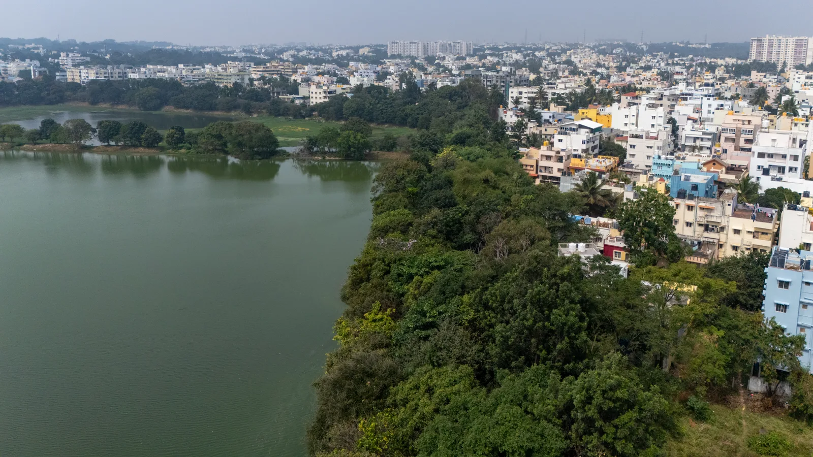
What is behind the fence is the second question, and a pop-up rarely answers it. A plot with the forest behind it and one with the access road behind it are very diffrent products at the same price, and on a visit you see the difference in seconds. On screen, the 3D scene has to do that job. The road, the tree line and the neighbour's roof are modelled next to the plots, so the buyer can look over the fence from above. It is the nearest thing to standing there. At Kownatki the lake and the forest edge sit right in the scene beside the houses, because that setting is a big part of what people were buying.
Live availability the sales desk controls
Availability is where a plot finder earns or loses trust. A house marked available is a promise to a stranger, and one stale sale is enough to break it with that buyer. In our projects the map, the listing and the house card all read from the one record the sales desk updates in the back panel, so a house turns yellow the minute a rep marks it reserved, and red once the contract is signed. Kownatki runs this across three build stages: houses in a stage that is not open yet are shown as such, and sold houses switch to price on request, so an old figure is not left on the page. Having one record that every page reads from is mostly a data decision, and it is worth making before the design work starts.
Comparing two houses on one screen
Comparison is the part most plot finders skip, and it is often what ends the phone call. A buyer who is down to two plots wants to see them together: plot size, house size, which way each one faces and what each backs onto. Kownatki has that, along with a favourites list and a house card for each home that you can download, so a couple can lay two houses side by side at the kitchen table. It is an optional part of a project. Ask for it. What the buyer compared is saved as well, so the client's sales team opens the enquiry already knowing which two houses were in the running.
Fifty plots, or twenty that differ
Twenty houses is small enough to scroll through, and Kownatki still got filters and comparison, because the houses vary a lot. The homes come in diffrent sizes, the plots differ by close to 300 m2 between the smallest and the largest, and the estate opens stage by stage, so a buyer looking at one house wants to know how it stacks up against another before driving out to the lake. Variation is one reason to add filters. Count is the other. In our experience, once an estate goes past about fifty plots, a map on its own stops working as a way to browse even when every plot is alike, simply because a map cannot filter, sort or compare. At 528 units, which is what Safa Al Fursan in Riyadh has, the buyer picks a zone first, then a building, then a unit, and the masterplan has to make that order obvious before anything else on the page matters.
The downside is that most of this work is data work, with very little 3D in it, and it lands on the developer's side. Someone has to own the unit records: fill in orientation and plot area once, mark a house reserved on the day the broker reserves it, and open a stage when it is actually for sale. Usually that is the marketing team. Sometimes it is one person in sales with a spreadsheet that only she can open, and in that situation I would rather show fewer fields than a field that is wrong. What shapes the size of a project is the plot count, whether that data already exists somewhere, and whether a CRM has to stay in step with it. A productised project takes two to four weeks and a bespoke estate two to three months, and in my experience the plot data holds up a launch more often than the renders do.
The verdict, and what would change it
On a small estate with plots all much the same size, a clickable map with live availability is enough, and Malinowskiego sells fine that way. Once the plots differ, or once there are more than about fifty of them, the map needs the four answers built in, and someone at the developer named as the person who keeps them current. The map is still the first thing you build. It is also the cheapest part.
I would change my mind if I saw a varied estate where buyers shortlist just as well from a bare map, which would show up as calls that stop asking about the garden and the fence. I have not had one yet. A developer with no one to keep the records current would change it the other way: for that client I would suggest the bare map on purpose, with fewer promises on it, and say so in the proposal.
See how it works on a live estate
Kownatki, Safa Al Fursan and Kozielska Park run on Vinode. Open one on your phone.

How to commission a development flythrough (and what to measure)
A sales director is asked by his board which reservations the launch film brought in, and cannot name one. What a flythrough can actually do, how to commission it so a later design change is one re-rendered shot, and what to measure instead of views.
Masterplan 3D for Phased Estates: How to Show Phase One Without Overselling Later Phases
A phased estate contains several levels of certainty at once. The masterplan should make that difference visible, then absorb a later-zone redesign without discrediting the phase-one material buyers already saw.
We Already Have a CRM: What Syncs and What Stays Separate
Two agents promise the same apartment on the same morning, and the sales director asks whether to replace a CRM her team likes. Keep it, add a launch tool beside it, and decide which data lives where.